[UPDATES BELOW]
Hurricane Milton is now as strong a category 4 hurricane as it gets and is barreling towards Florida 14 mph, expected to make landfall after midnight on the east coast.
Hurricane winds as of 10 A.M. eastern were 155 mph, which is just 2 mph below a category 5 hurricane.
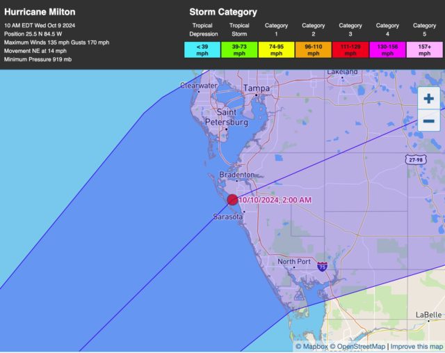
This is the current projection for where Milton will make landfall:
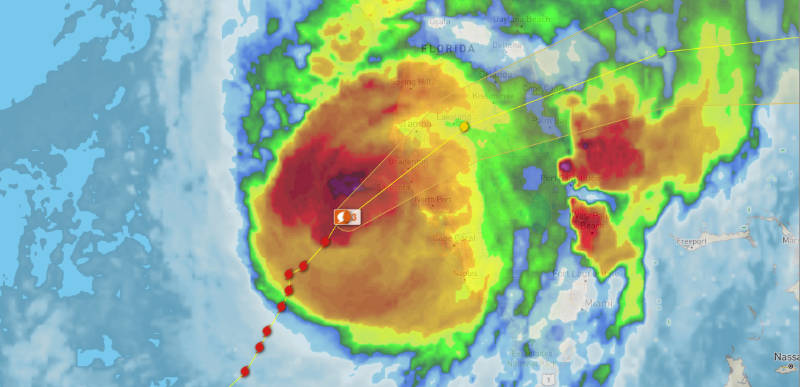
A tornado has already been spotted in Florida as this behemoth approaches:
MILTON LATEST: A tornado was spotted crossing Interstate 75 in Glades County, Florida, Wednesday morning as Hurricane Milton approaches the state.
Follow live storm updates: https://t.co/TdNd0kcmXY pic.twitter.com/7eYDjm3pxF
— ABC News (@ABC) October 9, 2024
Below is a video of Milton that was taken from space:
[embedded content]
Needless to say, but if you are still in the areas were Florida will impact you should be leaving now. Seriously. Storm surges are predicted up to 15 feet and that is catastrophic.
I’ll update here with any new information as the next report comes out.
: The forecasted landfall location is a little different but not much. It’s just south now of where they were predicting at 10AM:
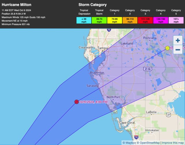
Also the wind speed of Milton is now 145 mph. So it is weakening a little as it approaches the west coast of Florida.
Hurricane Milton has weakened to a strong category 3 hurricane with wind speeds at 120 mph. It is traveling about 15 mph as it heads toward Florida.
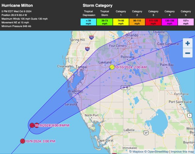
The NHC has changed the location where they believe Milton will come on shore and they’ve moved it back north toward Tampa Bay, bringing it back closer to Bradenton:
: Below is new video of Milton and it is massive:
NOW: #Milton is a beast of a hurricane & is approaching Florida’s coast pic.twitter.com/SDbdcda3vi
— Breaking911 (@Breaking911) October 9, 2024
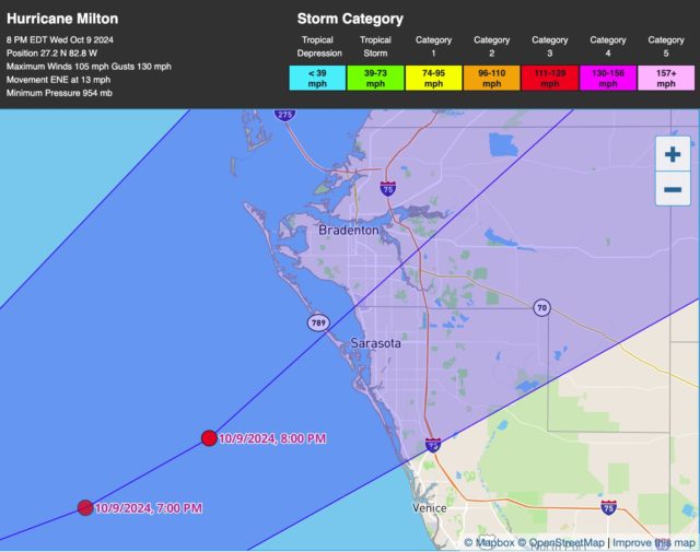
Milton is still a strong category 3 hurricane with wind speeds of 120 mph and it’s moving at a slower pace of 13 mph. It has certainly continued to grow in size, as expected, and here’s the latest prediction of where it will make landfall:
They are still predicting 10ft or greater storm surge with damaging waves. I hope none of you are on the Florida coast in the impact zone.
I’m seeing wind speeds on the ground upwards of 56 mph with gusts near 70 mph already from local weather stations near the impact area.