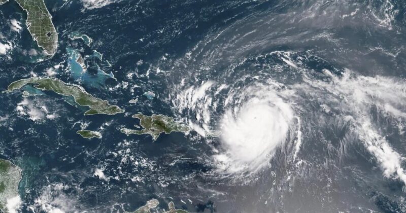
Hurricane Erin swelled to a Category 5 storm in the Caribbean on Saturday — the strongest category possible — and could unleash “life-threatening surf and rip currents” on East Coast beaches early next week, according to the National Hurricane Center.
From Tropical Storm to Monster in 24 Hours
Erin rapidly intensified from a tropical storm into a full-blown hurricane in just 24 hours, with winds doubling to 160 mph by Saturday morning.
Fox Weather meteorologist Cody Braud told The Post that Erin “has exceeded all expectations” and will remain “rather strong” for at least the next two to three days.
Dangerous Impacts Expected Along East Coast
While Erin is not forecast to make landfall in the United States, it will cause hazardous conditions.
“We are expecting extremely large waves to slam into the East Coast all next week,” Braud warned. “It will be very dangerous if anybody is deciding to venture out there.”
AccuWeather noted that coastal areas like Long Island, Cape Cod, and the Outer Banks face the highest risk of severe surf, rip currents, and beach erosion.
Storm Track and Watches Issued
As of Saturday, Erin was moving north of the U.S. Virgin Islands and Puerto Rico, on track toward the Turks and Caicos and the Bahamas before turning into the open Atlantic.
Tropical storm watches have been issued for St. Martin, St. Barts, and St. Maarten, where heavy rains could trigger flooding and mudslides.
Hurricane Season Outlook
Erin is the first Atlantic hurricane of 2025 and the fifth named storm of the season.
The National Hurricane Center projects up to 10 hurricanes, with as many as five reaching major status (winds of 110 mph or more) before the season ends on Nov. 30.