

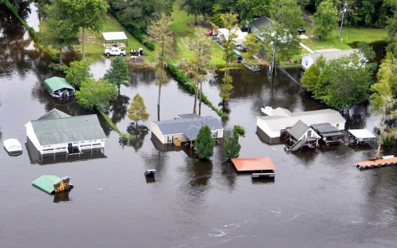
A powerful storm system is currently impacting the eastern U.S., with hazardous conditions affecting an estimated 120 million individuals. Catastrophic flooding is resulting in evacuations and prompting urgent emergency alerts across Southern states.
The first significant effects of this storm were felt overnight on the Georgia-Tennessee border, causing rivers to overflow and flooding numerous neighborhoods.
By Thursday morning, the National Weather Service had declared flash flood emergencies in parts of northern Georgia and southeastern Tennessee. Residents are cautioned that the rapidly rising waters present a serious danger to their safety.
“This is a particularly dangerous situation. Seek higher ground now! Life threatening flash flooding of low water crossings, small creeks and streams, urban areas, highways, streets and underpasses.”
Fannin County in Georgia and Polk County in Tennessee have reported severe impacts after torrential rain overwhelmed local waterways.
Reports indicate that some areas received over six inches of rain, with higher totals in sections of northern Georgia.
FLASH FLOOD EMERGENCY STRIKES GEORGIA TOWN: Torrential rain drenched thousands of people in Fannin County, Georgia, triggering a flash flood emergency as the wet conditions have overtaken communities, leaving them unrecognizable.
#Rain #Flooding #Georgia #FOXWeather https://t.co/eoGgTzDihu
— FOX Weather (@foxweather) November 5, 2026
In McCaysville, Georgia, and Copperhill, Tennessee, floodwaters inundated streets and buildings, prompting emergency crews to rescue trapped residents.
Local rivers like the Toccoa and Ocoee saw a significant rise due to runoff, creating perilous situations for communities and businesses.
Evacuations are mandated as flooding escalates, and drivers are advised to avoid flooded roads.
POLL: Should The Ten Commandments Be Allowed In Every Public School?
The National Weather Service indicated some locations are experiencing devastating flooding, affecting both homes and businesses.
However, the destruction seen at the Georgia-Tennessee border could be just the start of a larger weather event.
Experts warn that this powerful low-pressure system will continue towards the Mid-Atlantic and Northeast, bringing significant rainfall to as many as 23 states.
Thunderstorms are expected to become more intense in the Carolinas, while heavy rain spreads northward into Virginia, Maryland, Pennsylvania, and New England.
Major cities such as New York City, Boston, Hartford, Atlantic City and Norfolk could face significant disruptions as the system advances along the East Coast.
AccuWeather meteorologists have indicated that the storm might linger until Saturday, raising the risk of flooding in vulnerable regions.
HAPPENING NOW: A flash flood emergency southeast Tennessee and north Georgia has the city of McCaysville shut down with water rescues ongoing. #GMN https://t.co/RH9sdwN4MX
— WKRN News 2 (@WKRN) November 5, 2026
There are concerns that the system could decelerate upon reaching the Atlantic Coast, leading to continuous heavy rain over the same areas.
AccuWeather senior meteorologist Brett Anderson explains that this situation heightens the risk of flash flooding because heavier rain can repeatedly affect certain regions.
A separate atmospheric disturbance could also exacerbate conditions, leading to prolonged rainfall in already drenched areas.
Forecasters advise that even communities spared from major flooding may still encounter dangerous driving conditions.
AccuWeather meteorologist Tyler Roys warns that recent dry weather can make roads particularly slick when it rains.
Even light rain can render roads treacherous after a dry spell, as oil, dust, and debris accumulate on pavement.
Motorists are urged to slow down, increase their stopping distance, and avoid roads covered with water.
The National Weather Service has issued a stark reminder that attempting to drive through floodwaters can be fatal.
‘Turn around, don`t drown when encountering flooded roads. Most flood deaths occur in vehicles,’ the agency cautioned.
RELATED: Hurricane Vance Expected To Strengthen To Major Category 3 Storm
The storm may also bring a sharp drop in temperatures as cold air pushes south from Canada.
<pForecasts suggest that parts of the Northeast could see temperatures drop into the 40s and 50s, with potential snowfall in higher elevations.
Maine, New Hampshire, Vermont, New York, Pennsylvania, Ohio, and Michigan might experience wintry weather as the colder air arrives.
This temperature shift coincides with disruptions in the polar vortex, a system of winds that typically keeps cold air confined near the Arctic.
When this circulation weakens, colder weather can penetrate deeper into the U.S.
In the meantime, emergency services are prioritizing the rising flooding threats as the storm heads toward the Northeast.
With homes affected along the Georgia-Tennessee border and millions facing heavy rain, authorities are urging people to stay alert to local weather updates and comply with evacuation orders.
The National Weather Service has confirmed life-threatening flooding in northern Georgia and southeastern Tennessee, while additional areas might experience perilous conditions through Saturday.
